
Scenic Drives Near Livermore, CA for Golden Hour Photos and Relaxed Cruising
Discover the most breathtaking scenic drives near Livermore, CA perfect for golden hour photography, weekend cruising, and unforgettable valley views.
Some roads exist purely to get you somewhere. Others exist to remind you why you love to drive. The roads surrounding Livermore fall firmly into the second category. Winding through golden hillsides, dipping into shaded canyons, opening up to sweeping valley views, these routes reward anyone willing to slow down and actually enjoy the journey. Whether you're chasing the perfect golden hour shot or just carving through curves on a Sunday afternoon, this part of California genuinely delivers.
Why the Roads Around Livermore Were Made for a Relaxed Cruise
Livermore sits at the eastern edge of the Bay Area, where dense suburban sprawl gives way to something genuinely beautiful. The terrain shifts quickly here, moving from valley flatlands into rolling hills and open ranch land. That variety is exactly what makes the scenic drives near Livermore, CA so satisfying. You don't need to travel far to feel like you've left the city entirely behind.
The region's mild, Mediterranean-style climate means most of these routes are enjoyable year-round. Spring brings wildflowers and green hillsides. Summer afternoons glow with warm, amber light. Fall softens everything with earthy tones, and winter storms leave the hills lush and dramatic. Each season offers its own version of the same essential experience: wide-open California roads with minimal traffic and plenty of reasons to pull over.
Mines Road: The Crown Jewel of Scenic Drives Near Livermore, CA
Ask any local driver which road they'd choose on a free afternoon, and Mines Road comes up almost every time. Running south from the edge of Livermore toward Mount Hamilton, this route covers roughly 50 miles of undeveloped California at its most raw. Mile markers painted directly on the pavement count up to the Santa Clara county line at 20 miles, then back down 26 miles to the top of Mount Hamilton. No strip malls, no traffic signals, no distractions. Just road, hills, sky, and the quiet satisfaction of a drive done right.
What to Expect on the Drive
Mines Road begins near the junction with Tesla Road and climbs steadily into increasingly remote terrain. The landscape shifts from open grassland into rugged chaparral and deep canyons around Cedar Mountain, with every curve revealing a different configuration of ridgeline and sky. Wildlife sightings are genuinely common out here. Deer, red-tailed hawks, and the occasional coyote are regular companions. The road demands real attention in places, since narrow curves and occasional rough patches reward smooth, confident driving rather than rushed acceleration. This is not a road to underestimate.
The experience is distinctly immersive. With no cell service for long stretches and minimal signage, Mines Road has an off-the-grid quality that feels increasingly rare this close to a major metro area. It asks you to be present, attentive, and genuinely engaged with the act of driving.
Best Time of Day and When to Pull Over
Golden hour on Mines Road is worth planning specifically for. In the late afternoon, the low California sun catches the hillsides at a shallow angle and turns everything a warm, saturated amber. Natural pullouts along the route let you stop safely and let the landscape do what it does best. For photographers, the combination of dramatic topography and an unpolluted sky makes this one of the finest shooting locations in the entire Bay Area.
Early mornings offer a different kind of reward. The road is completely quiet, the air is cool, and wildlife activity peaks before the day warms up. If you're heading out before sunrise, build in extra time for the return trip. Once the hills light up, you won't want to rush.
Tesla Road and the Livermore Hills Loop
Tesla Road runs east from Livermore into the Livermore Hills before connecting back toward Mines Road, threading through a wine country corridor that passes more than 50 wineries. On its own, it's a satisfying stretch through open range and vineyard rows, with weathered oak trees lining much of the way. As part of a loop with Mines Road, it becomes something more: a half-day drive covering genuinely varied terrain without ever feeling repetitive.
This is Livermore Valley wine country without the Napa crowds, and that distinction matters. Spring is the standout season, when the hillsides turn emerald and the vines begin to bloom. Late afternoon year-round brings golden light across the vineyard rows in a way that rewards even a brief pull-over. Garré Vineyard & Winery sits along this corridor and offers panoramic views across the valley floor. A midday stop there adds a relaxed, unhurried rhythm to the whole outing. The roads are wider than Mines Road in most sections and the grades are gentler, making this loop a solid introduction for anyone new to driving the hills east of Livermore.
Niles Canyon Road (CA-84 West): Canyon Curves Toward Fremont
Heading west from Livermore on CA-84 takes you into Niles Canyon, an officially designated scenic route running from Fremont's Niles District to Sunol. The road follows Alameda Creek through a narrow canyon lined with bay laurel, sycamore, and willow, with the creek visible through the trees for much of the route. The canyon walls compress and shape afternoon light differently than an open ridgeline does, creating pockets of shadow and warmth that shift as you move through the curves. It's the kind of place photographers return to repeatedly because the conditions are never quite the same twice.
Niles Canyon also carries real historical weight. The area served as a significant corridor for early California settlers and later became an important railroad route; that layered past gives the drive a sense of place you can feel even without knowing the history. Summer turns the hills golden-brown above the tree line, while winter rains bring everything back to green. The western end opens into the town of Niles, worth a brief stop if the timing suits you.
Del Valle Road: A Short, Quiet Escape Into the Hills
Not every great drive needs to be a long one. Del Valle Road runs about 10 miles south of Livermore into the hills, ending at Del Valle Regional Park, where a five-mile-long lake sits surrounded by 4,395 acres of oak-covered terrain. The road itself is lightly traveled and calm, with the scenery transitioning quickly from suburban edges into genuine countryside.
The park adds real value to the outing. At golden hour, the light catches the ridgelines above the lake in a way that makes the short drive entirely worth it. As a weekday evening excursion timed around sunset, Del Valle Road punches well above its modest length.
The Drive to Napa via CA-84 and the Silverado Trail
The Livermore to Napa corridor is one of California's genuinely underrated day trips. Most people default to Highway 29 when heading to wine country, but the route through CA-84 and the Silverado Trail offers something considerably more interesting. Starting from Livermore, you take CA-84 north and cross into the Napa Valley, then pick up the Silverado Trail for the northbound stretch through the vineyards.
Why This Route Feels Like a Different World
The transition from the Livermore Valley into Napa happens gradually, which is part of what makes it so satisfying. The landscape shifts from dry California hill country into the cultivated elegance of wine country, with vineyard rows running in clean lines across the valley floor. The Silverado Trail runs 29 miles along the eastern edge of Napa Valley, well clear of the commercial traffic on Highway 29, and delivers a quieter, more scenic version of the experience from start to finish. Traffic is noticeably lighter, and the road rewards a comfortable, unhurried pace.
October is the standout month on this route. The vines turn yellow and red along the trail, and the combination of harvest activity and autumn color makes for some of the richest photography of the year.
Stops Worth Adding Along the Way
The Silverado Trail is lined with smaller, appointment-based wineries that tend to offer more intimate tasting experiences than the larger estates on Highway 29. Plan ahead and a mid-afternoon stop adds a genuinely memorable dimension to the drive. Yountville is worth a detour if you're interested in dining, and the Oxbow Public Market in Napa makes an excellent final stop before heading south.
Practical Notes for Each Route: Timing, Terrain, and What to Bring
Planning pays off on these drives. Mines Road and the Livermore to Napa route are best tackled when you have at least a half-day available. Rushing either one costs you the best parts. For Niles Canyon and Del Valle Road, a two-hour window is more than enough, and both work well as evening drives timed around golden hour.
All of these routes are paved, but Mines Road has rougher patches toward its southern end and occasional potholes after winter rains. Bring water regardless of season, since the hills run warmer than the valley floor. Download offline navigation before heading out; cell service on Mines Road and parts of the Napa route is intermittent at best.
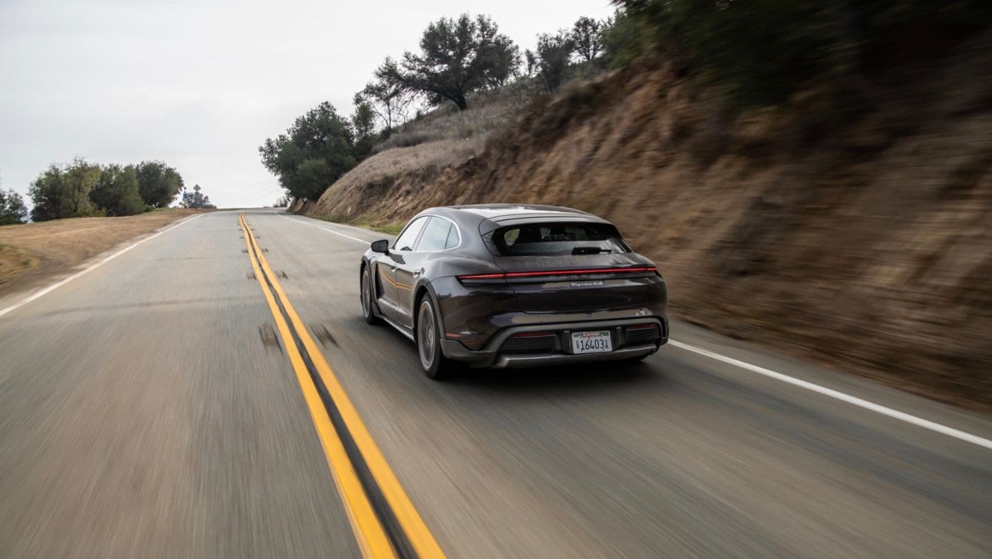
Start Your Next Drive at Porsche Livermore
Every one of these routes rewards a car that's genuinely enjoyable to drive. The curves on Mines Road, the canyon flow of Niles Canyon, the long vineyard straightaways on the Silverado Trail; all of it responds to a vehicle that handles with precision and accelerates with confidence. That's exactly the kind of experience Porsche Livermore is built around.
Stop by at 3100 Las Positas Rd, Livermore, CA 94551, contact our team at (925) 344-5488, or browse the current inventory online. The road is ready. The only question is which one you'll take first.